
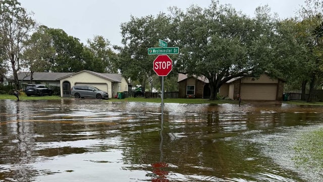
Heavy rains have turned central Florida into a flood zone, prompting more than a hundred water rescues after some areas received over two feet of precipitation in the last two days. The danger is still present.
In Brevard County, the St. Johns River surged to a new peak of just over 18 feet, surpassing a level that had stood for seven decades. The city of Cocoa Beach accounted for many of the rescues.
Brevard County Sheriff Wayne Ivey told reporters on Thursday that, although property damage is extensive—vehicles and businesses have been hit—no fatalities have been reported and injuries have been few. “The most important thing is that nobody has lost their life,” he said.
The heaviest downpours are now focused on the Space Coast near Cape Canaveral, where officials have issued a rare high‑risk flash‑flood warning for Friday.
Robert Spinning, whose entire block is submerged, said on “CBS Mornings” that he is extremely anxious. “I don’t have flood insurance and I can’t afford it,” he said.
A flood watch continues for the entire east coast of Florida through at least 7 p.m. on Friday, with forecasters expecting an additional six to eight inches of rain before the weather eases over the weekend.
The St. Johns River is expected to keep climbing through Friday night, potentially reaching 18.6 feet—about a foot higher than the previous record set in 1953—and could remain at record levels through the following Tuesday.
In Palm Bay, floodwaters again washed away a section of the Port Malabar Boulevard Bridge, just days after the town held a ceremony to reopen it on Monday.
Melbourne is now on track for its wettest November ever, having logged more than 17 inches of rain this month. Cape Canaveral has already accumulated 26.9 inches in the past 48 hours, while nearby Oak Hill recorded 17.3 inches in the same period.
The same system that is battering Florida is expected to move northward along the Atlantic seaboard and may acquire some tropical characteristics. The National Weather Service estimates a 50 percent chance that it will be designated Subtropical Storm Kyle on Sunday.