
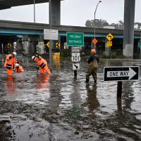
Storms battered both coasts on Wednesday and Thursday, as a powerful El Niño resurfaced, shattering rain records and prompting coastal flooding in California and Florida.
In downtown San Francisco, Wednesday’s rain reached 2.64 inches, eclipsing the previous daily high of 2.24 inches set on Nov. 18, 1918. “Yesterday completely smashed those records,” said Anamaria Navarette, a meteorologist with the National Weather Service’s San Francisco Bay Area office. “El Niño certainly is playing a part in the event.” The Bay also saw two waterspouts—rotating, tornado‑like columns of moisture—form on Wednesday, with a third near Santa Cruz to the south. Strong gusts toppled trees and snapped power lines, while the downpour soaked areas still recovering from earlier wildfires, triggering flash‑flood warnings.
Along Florida’s Atlantic shoreline, more than a foot of rain fell over the last 48 hours, drenching the same communities that endured historic precipitation just two weeks earlier—a storm that had forced the relocation of ballot boxes on Election Day. Melissa Watson, a National Weather Service forecaster based in Melbourne, Florida, described the recent weather in similar terms to her San Francisco counterpart. “Quite a few records were broken yesterday,” she said over the phone, with alert sirens audible in the background. “We are in that strong El Niño pattern.” Because earlier storms this month left much of the Space Coast saturated, the fresh rain pushed the region’s flash‑flood risk to its highest level on Thursday. “The water isn’t infiltrating at all; the soils are completely saturated,” Watson explained.
Scientists link the twin coastal deluges to El Niño because the phenomenon intensifies Pacific storm systems that affect the West Coast while also reshaping the southern jet stream to steer more moisture‑laden storms toward the Southeast. NOAA data indicate that, for the August‑through‑October period, this year’s El Niño ranks as the second‑strongest on record, even when the influence of climate change is excluded, and the agency expects the pattern to linger into May.
El Niño is a natural climate oscillation that arises when equatorial trade winds weaken, allowing warmer water to remain near the surface of the eastern Pacific and raising global temperatures. In California, most fall and winter precipitation—whether or not El Niño is present—comes from atmospheric rivers, narrow corridors of tropical or subtropical moisture that travel across the Pacific. A 2022 study estimated that atmospheric‑river events cause roughly $1.1 billion in flood damage each year, accounting for about 84 % of flood losses in western states. While El Niño does not necessarily increase the frequency of these rivers, the warmer Pacific waters can boost their intensity. Off Monterey, sea‑surface temperatures were about 12 °F above normal, Navarette noted. “A lot of the moisture we saw surging through yesterday was definitely amplified by those warm ocean temperatures,” she added.
In the Southeast and Gulf Coast, El Niño typically brings cooler air but pushes storm tracks farther south. Daytona Beach recorded nearly 5.8 inches of rain on Wednesday, shattering its previous daily record by more than five inches, according to Watson. By Thursday morning, 11 million Floridians were under a flood watch. Local officials in Melbourne opened an emergency shelter at a community center, and Governor Ron DeSantis dispatched hundreds of National Guard and State Guard members, along with highway patrol and wildlife officers, to assist with flood response.
Forecasts for Thursday called for rain rates as high as four inches per hour in parts of Florida. By Saturday, meteorologists anticipate an additional four to eight inches of rain along the coastline, with isolated spots potentially seeing 12 to 15 inches, raising the likelihood of further flooding.